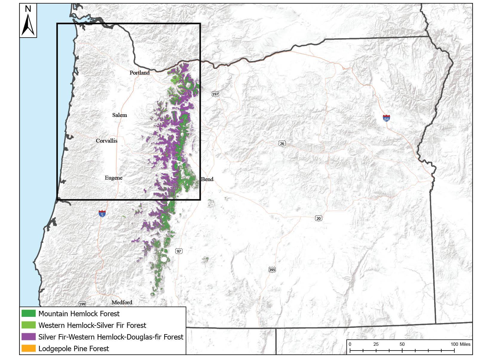
Fire in the West Cascades' high-elevation forests
Oregon’s Cascade mountains stretch the length of the state from north to south, with pass elevations typically around 5,000 feet, and multiple mountain peaks exceeding 9,000 feet. Forests reach nearly 8,000 feet elevation where conditions allow. Fire occurrence and its impact in Oregon’s western Cascade high-elevation forests is variable and influenced by climatic factors, landforms, quantities and arrangement of fuel, and human activities.
Lightning occurs frequently along the Cascade crest, resulting from weather fronts moving across or along the mountain chain or arising locally as summer heat causes air to rise and form storm clouds near or over peaks. It is not uncommon for lightning storms to produce dozens (sometimes hundreds) of strikes along the crest. Many are extinguished by the storm’s rainfall, but some smolder in snags or ground fuels and are stoked into action later by dry weather conditions. Dry lightning heightens the risk of wildfire and is relatively common in this region. While lighting is the primary ignition source in the southern Cascades, humans are by far the primary source of ignition for fires in the northern Cascades (particularly around Mount Hood). “Stripes” and “pockets” of human-caused ignitions occur throughout the Cascades along roads and around lakes and other features that attract people.
Snowpack often persists at higher elevations, limiting the fire season to late summer and early fall. The short growing season and generally cool summer temperatures also limit growth of understory plant species, which means there is less fuel to carry fire along the forest floor. Without this surface fire to heat and dry tree crowns, crown fire is limited to extreme weather conditions in which high winds are coupled with high temperatures, low humidity or both. An example of this was the 2020 Thielsen Fire, which began near the tree line and was pushed by an east wind event.
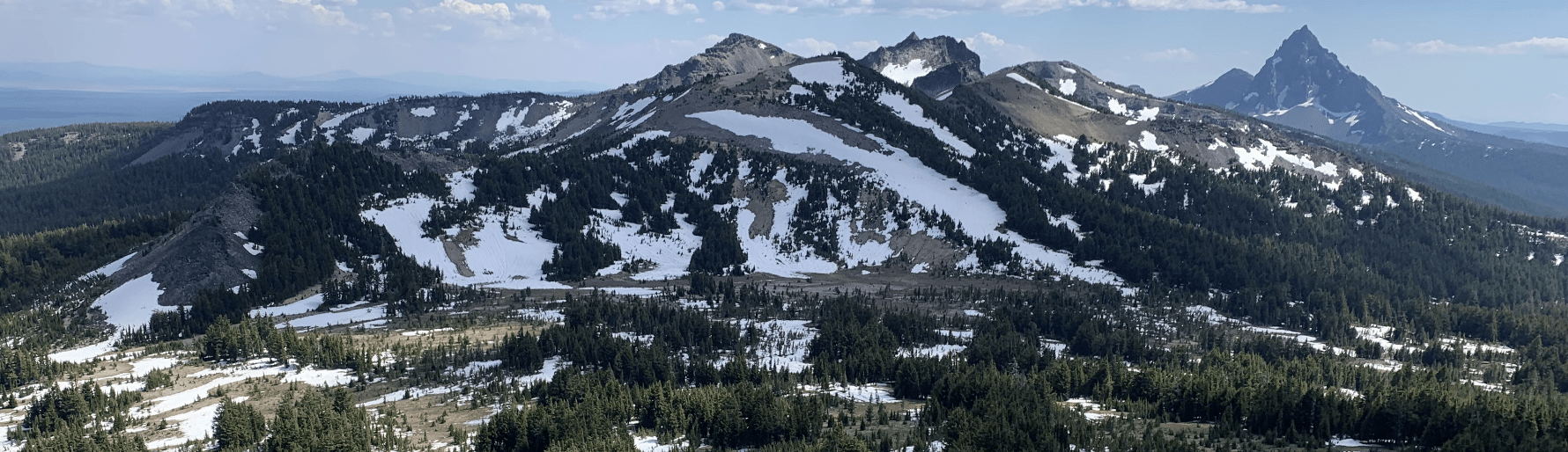
Fire size and spread is also limited by the area’s topography and soils. The flanks of Oregon’s Cascade volcanos are generally steep and rocky, with insufficient vegetation to carry a fire. Flatter areas may have a high pumice content, limiting vegetation’s growth. These areas serve as natural firebreaks. In other areas of the Cascades, forests grow at relatively high densities.
Maps of fire regimes often show the Oregon Cascades as historically having a low-frequency, high-intensity fire regime. This is perhaps true in that the big fires that kill a lot of trees happen infrequently in any area. However, smaller, lower-intensity fires are frequent in this area and are important to the area’s ecology and forest development. The result is a high-elevation landscape with a patchwork of burns and associated forest conditions.
Oregon's west Cascadess high-elevation forests
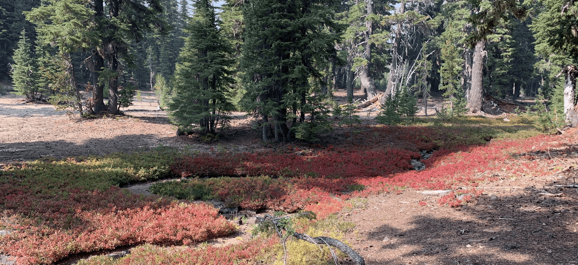
Trees growing throughout the Cascade crest are adapted to relatively cool summer temperatures and moderately cold winters. Much of the precipitation is snow, and summers can be quite dry. Growing seasons are shorter than at lower elevation. Forests can be relatively dense and include many shade-tolerant species (such as mountain hemlock), often with narrow crowns that efficiently shed the Cascades’ “wet” snows. Understories tend to have limited vegetation, with shrubs (such as manzanita or huckleberry) and a variety of forbs growing in patches. Downed wood from fallen trees is common, but with patchy distribution.
Mountain hemlock is common along the Oregon Cascade crest at an elevation between 5,000 and 6,000 feet. Other species at these elevations include noble fir in the northern Cascades, and Shasta fir (a noble fir/California red fir hybrid) in the southern Cascades. Pacific silver fir may be included, or even prevalent, in the middle to northern Cascades. Lodgepole pine may occur in a mix with other species or in nearly pure stands where conditions are cold or where the soil has a high pumice content. Douglas-fir and grand fir will overlap along the western, lower-elevation edges of the Cascade crest, as will ponderosa pine along the eastern edge. Sugar pine and even some incense cedar will occur at the southern end of Oregon’s Cascades.
Above 6,000 feet, subalpine fir becomes increasingly dominant until it transitions to whitebark pine just below tree line. These two species have thin bark and are easily killed by fire but have differing fire strategies. Subalpine fir restores its population by reseeding burned areas from pockets of trees surviving the fire. Whitebark pine stands tend to be so sparse and hold so little understory vegetation that fire doesn’t carry well where they grow.
Fire resilience strategies for small woodland owners in this forest type
Given the natural ecology of these high-elevation forests, managing for open, fire-resistant conditions may not be desirable or feasible. Instead, consider strategic management options to reduce your property’s likelihood of being negatively impacted by wildfire. Apply common home hardening and defensible space practices if you live within this landscape. Maintain a nonflammable area around all structures. Near structures and out to about 100 feet (200 feet on a slope), thin trees to wider spacing to break up the continuity of the crowns and limit fire spread to your home. Manage the amount of shrub or grass growth and thin or remove tree seedlings to prevent them from becoming ladder fuels. Create and maintain shaded fuel breaks (areas with carefully managed tree density and minimal understory fuel) along access roads. If you own land beyond 100 feet of your home, consider managing for forest health.
Forests along the Cascade crest are predominantly owned or managed by the U.S. Forest Service. Engage with the Forest Service and other neighbors to encourage strategic management that promotes forest health and reduces overall fuel loads by creating a patchy landscape that is less likely to carry intense wildfire.
We are still learning
How climate change will impact forests along the Cascade crest is a looming question. Increasing annual average temperatures observed over the past century means trees are under increased moisture stress toward the end of summer, and perhaps earlier in the summer than previously. This leads to increased tree mortality and dead, woody fuel loading. Snowpack appears to be developing later and melting earlier, resulting in longer fire seasons. Warmer temperatures also mean a longer growing season for fuel accumulation. In some portions of the region, precipitation (as rain) may be increasing and may be more common in the summer, resulting in more vegetation that can fuel fires. In other areas of the crest, summer wetting rains have decreased. It’s difficult to anticipate how these intersecting factors may influence fire, but longer fire seasons and more fuel increases the risk of large fires. Proactive efforts to create defensible space and implement strategic management for the safety of your home and community and the health of the forest and landscape seems prudent.
For more information
Bailey, J.D. 2024. A walk with wildland fire. Waveland Press, Inc. Long Grove, Illinois.
Bennett, M, S. Fitzgerald, A. Christiansen and K. Baylog. 2017. Keeping your home and property safe from wildfire: A defensible space and fuel reduction guide for homeowners and landowners (EM 9184). Oregon State University Extension Catalog.
Detweiler, A.J., S. Fitzgerald, A. Cowan, N. Bell and T. Stokely. 2023. Fire-resistant plants for home landscapes: Reduce wildfire risk with proper plant selection and placement (PNW 590). Oregon State University Extension Catalog.
