Explore how fire and people’s relationship with it have shaped diverse ecosystems across the place we call Oregon.
How fire historically shaped the Blue Mountains
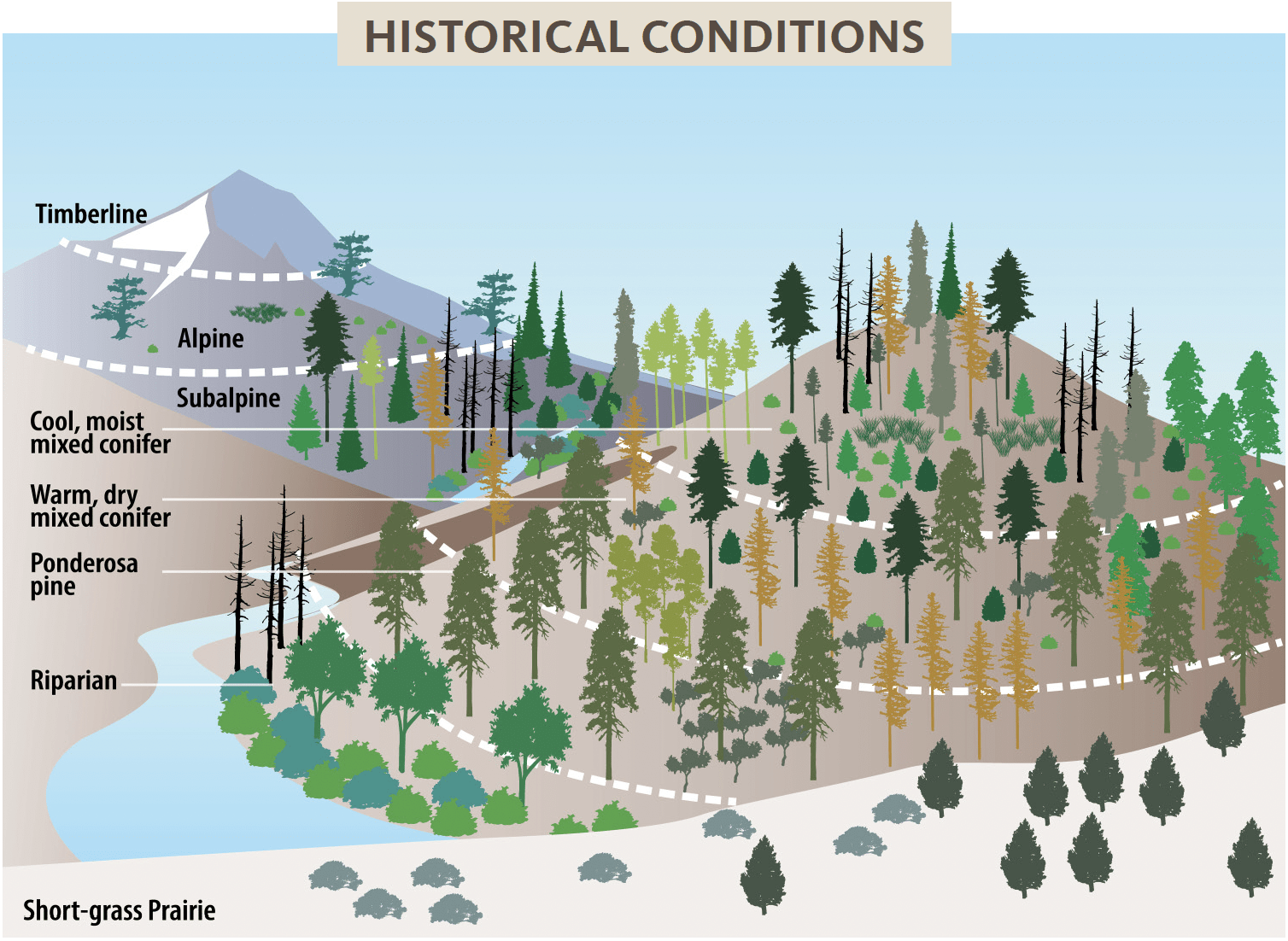
Before European settlement the Blue Mountains region was shaped by frequent fires ignited by lightning storms and Indigenous burning. Indigenous land stewards commonly burned in dry forests, often at regular intervals, resulting in low-severity surface fires. These practices killed small trees and consumed shrubs, grasses and fine surface fuels, keeping the overall fuel load low. Intentional burning favored fire-resistant species like ponderosa pine and western larch, allowing them to reach large size and old age.
Historically, these dry forests consisted of uneven-aged, widely spaced individual trees that were often very large. Trees also occurred in clumps and young trees formed patches in canopy openings or areas that escaped fire long enough for the trees to establish. Moist forests burned less frequently, although they still experienced a lot of fire. Fires in these denser forests varied in intensity and severity. Sometimes they crept through surface fuels and caused little damage to large trees, while at more drier and windy times they burned hot and killed patches of trees. Indigenous peoples applied fire in moist forests to maintain and promote huckleberry patches and meadows, both important food sources.
Higher elevation subalpine forests experienced mixed severity surface and crown fires with longer fire return intervals, but there was sufficient fire to maintain these forests in patchy conditions across the landscape and to keep trees from encroaching into meadows. The smoky blue air over the region likely inspired the Blue Mountains’ name.
Changes to the Blue Mountains fire patterns
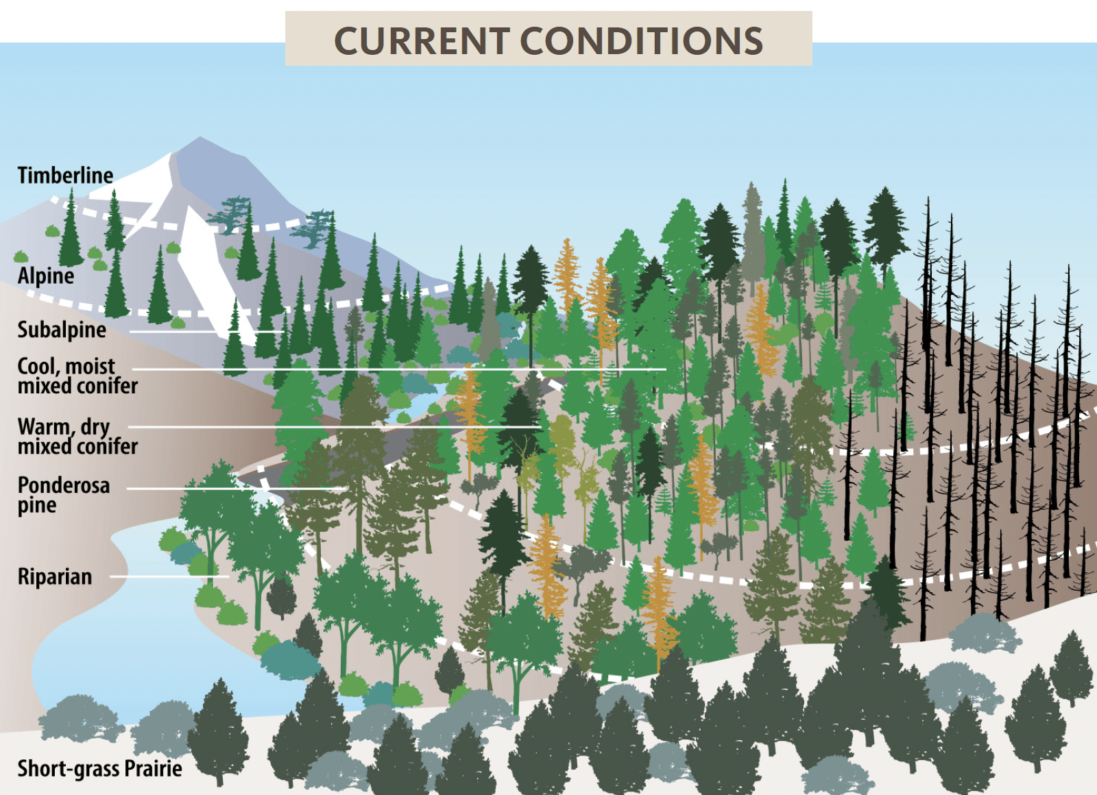
Fire suppression, changes in climate and human activities have reshaped the Blue Mountains’ forests. Increased fire severity in the Blues today can be attributed to more fuel (denser forests), greater continuity of fuel — the forests are more uniform and have fewer gaps, many of which have been filled by invasive annual grasses — and hotter and generally drier weather conditions that result in less snowpack and longer fire seasons.
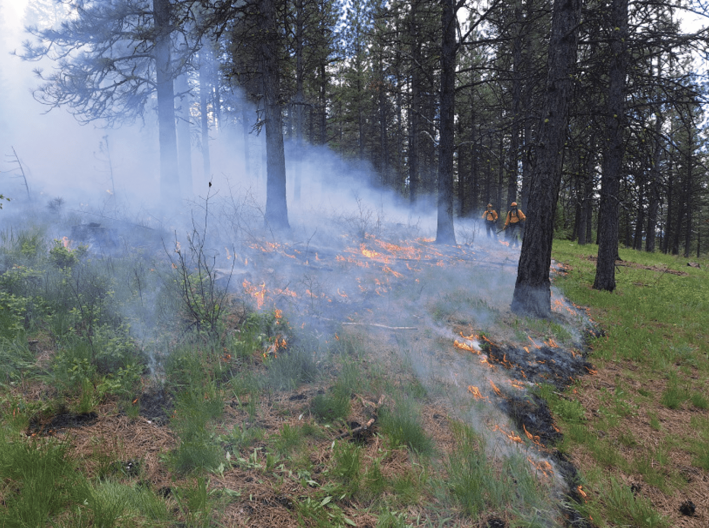
How fire shapes the Blue Mountains today
Fire exclusion, logging of the largest trees, and other factors have altered forest composition and structure in the Blue Mountains. Habitats in lower elevations have been impacted by invasive species, including non-native grasses that have increased vulnerability to wildfire in sagebrush shrublands and rangelands. Western juniper has dramatically increased its range within these lower elevation ecosystems.
Warm, dry forests now have fewer large, fire-resistant trees, a greater number of younger and more shade-tolerant trees, and much more vertical fuel continuity (i.e., ladder fuels) than in the past. Moist forests are also denser and are much more uniform across the landscape, allowing fire to burn larger areas. The high density of trees and other vegetation in the Blue Mountains has led to various forest health issues exacerbated by droughts and warmer temperatures.
Forest insects, such as bark beetles and wood borers, and some forest diseases thrive in overcrowded forests, which can lead to tree die-off and result in large accumulations of dead fuel in the years following these events. Dead fuel dries and burns easily and therefore can increase overall fire danger. As a result, these forests may experience more severe fires than the more open or patchy forests of the past.
To mitigate these undesirable consequences, forest managers across ownerships use integrated management approaches considering historical conditions, natural fire intervals (including cultural burning) and current management objectives. Thinning and prescribed burning are particularly effective for mitigating fire risk and increasing the overall health and resilience to climate change of the Blues ecoregion. Large, coordinated efforts by local, state and federal governments have aided management efforts that contribute to a more resilient Blues landscape.
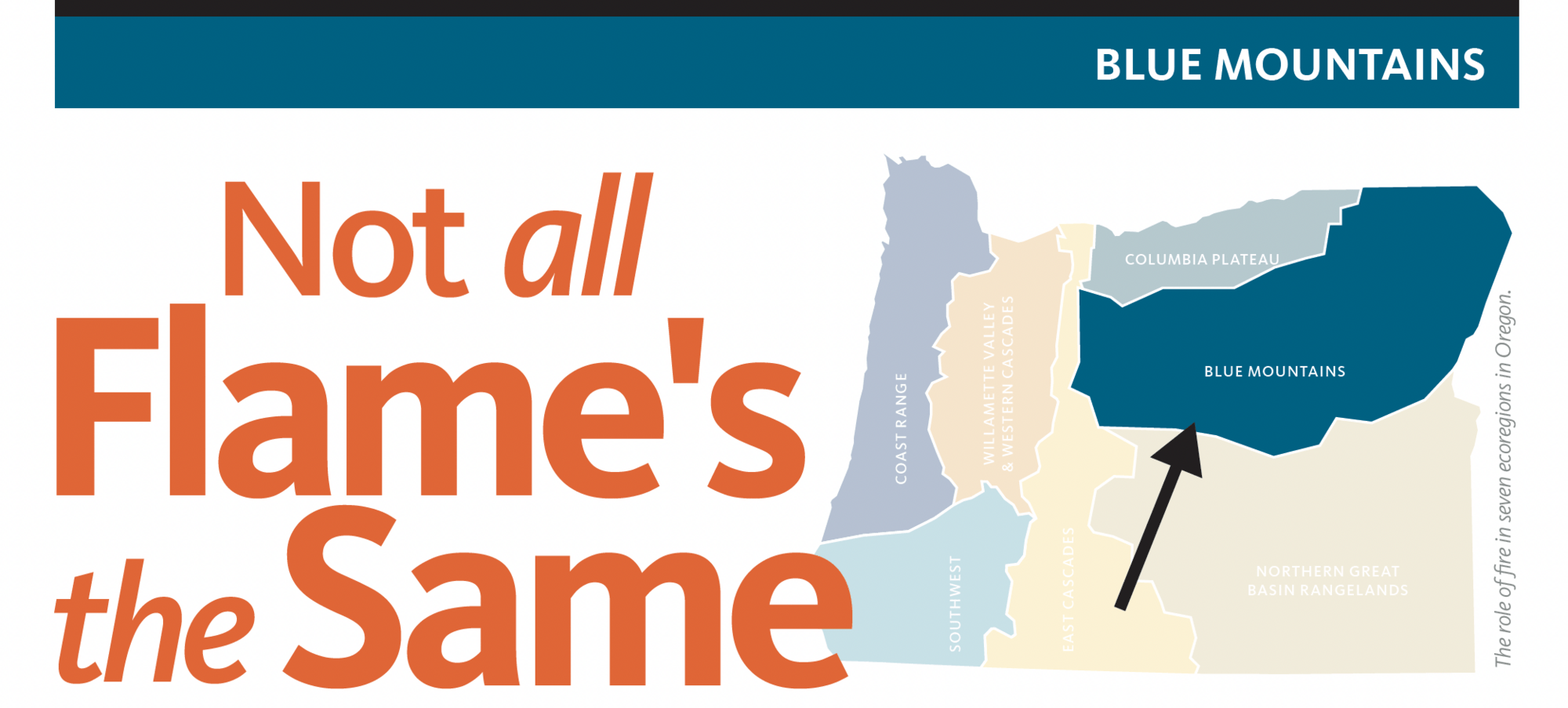
Not all flame’s the same
Fire has played a significant role in shaping landscapes throughout history, sparked by both lightning and the intentional use of fire by Indigenous peoples. Fire enabled people to manage and adapt to their local ecosystems, helping them produce food, tools, materials and medicines, as well as maintain prairies, clearings and travel routes. It also helped reduce the risk of larger, more destructive fires by preventing the accumulation of excess fuel. Beyond human use, fire serves vital ecological functions, such as clearing dead vegetation, recycling nutrients, creating habitats for plants and animals, promoting germination and new growth and controlling insects and diseases.
Oregon is a very diverse state from the coast to the Cascade Mountains and the Great Basin. Because of this, it makes sense that the way fire behaves also varies across the state. In other words, fire happens in different patterns and has different effects. This resource explains the role of fire in seven ecoregions of Oregon.
Ready to learn more? https://beav.es/NAFTS.
This publication was made possible with funding from the Oregon Forest Resources Institute in cooperation with the Forestry and Natural Resources Extension Program at Oregon State University.
About the authors


