This publication provides direction on estimating soil moisture by the "feel and appearance" method; taking a some soil and rolling it up in a ball then squeezing it between your thumb and forefinger to form a ribbon and noting how it appears and feels. Compare what you see with photographs and/or charts to estimate percent water available and the inches depleted below field capacity.
This document provides how-to photo instructions on how to find and download Ecological Site Descriptions (ESDs) using the Web Soil Survey (WSS) for use in a range management plan.
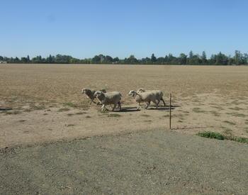
Irrigating pastures can provide livestock with nutrition long into summer. Learn to monitor soil moisture to determine when to irrigate and how much water to apply.
This report includes preliminary data for the second of a three-year study. Since this year was a record drought year, results could vary from a normal rainfall year. Finalized data and observations will be released in future as peer-reviewed studies, reports, and extension articles. For more information, please visit the RDFA project page. .
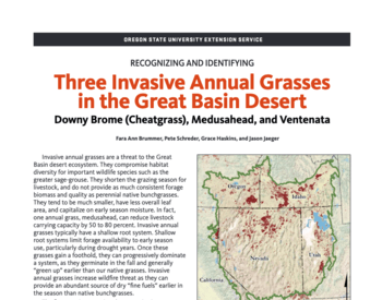
Invasive annual grasses are a threat to the Great Basin desert ecosystem. They compromise habitat diversity for important wildlife species such as the greater sage-grouse. They shorten the grazing season for ...
Fara Brummer, Peter Schreder, Grace Haskins, Jason Jaeger |
Feb 2018 |
Extension Catalog publicationPeer reviewed (Orange level)
Covers the history of yellow starthistle (Centaurea solstitialis L.) invasion of the Pacific Northwest and describes current infestation levels in Oregon and Washington. Provides basic information regarding yellow ...
Larry L. Larson, Roger Sheley, Michael McInnis, Gary Kiemnec |
Jan 2008 |
Extension Catalog publicationPeer reviewed (Orange level)
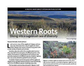
What may appear at first glance as a sea of sagebrush is in reality a complex and diverse ecosystem with a wide variety of plants and animals. The sagebrush steppe teems with life, but threats such as ...